Foreca Weather API
Foreca Weather API standard package includes access to point forecasts and weather maps.
API add-ons (Warning API, Marine API, Climate API, Ski API) can be added to the service for an additional fee. If you are interested in API add-ons, please contact our sales team for more information.
Learn more about Foreca’s different weather solutions at corporate.foreca.com.
Attribution
Customer shall display in its weather service the Foreca logo. In case displaying the logo is not possible due to technical reasons, the text ”Foreca” shall be displayed in customer’s weather service in connection with the content referring to the source of information. Customer agrees to cease use of the logo and name ”Foreca” in case requested by Foreca, and also to follow Foreca’s reasonable instructions in using the logo, trade name or other trademarks of Foreca.
https://corporate.foreca.com/en/logoThird Party Attributions
Customer’s application must show attribution as given in API response. For example, the Capabilities endpoint in Weather Map API responds with layer info telling the required attribution text.
Currently the following organisations must be attributed if their data is used:
Radar data: Aemet, BOM, DMI, DWD, EC, FMI, InMet, JMA, KMI, KNMI, MET, Eireann, MeteoSchweiz, MF, Met Office, MET Norway, NWS, Protezione Civile, SMHI, SMN, ZAMG
Satellite data: EUMETSAT
Authorization
Fetch tokens for API access. Tokens can be self-expiring or non-expiring.
Token
Create an expiring or non-expiring token (API key).
user
Application key username
password
Application key password
expire_hours (optional)
Expiry time in hours (default 1, maximum 168). If given expiry time is -1, a non-expiring token is created.
/authorize/token
{
  "access_token": "eyJ0eXAiOiJKV1QiLCJhbGciOiJIUzI1NiJ9.eyJpc3MiOiJodHRwOlwvXC9mbnc2LmZvcmVjYS5jb21cL2F1dGhvcml6ZVwvdG9rZW4iLCJpYXQiOjE1MjYzMDAzODAsImV4cCI6MTUyNjMwMzk4MCwibmJmIjoxNTI2MzAwMzgwLCJqdGkiOiJxSXl3WVlQNjc1NkczejBEIiwic3ViIjoibFFHa1Y4Z2pIeGUyZU1ibndUUUs4NktqVTY3RXJlS2htenY1IiwicHJ2IjoiYWY3YTAzOThkZGNiNWE3YTUzN2Q3YzdkMjU2NWEyZjgxZGM4ZTQxNCJ9.V8xg6L9yrY9__VH-jdrL_CqXisEpgcfdUa0NoxlGz0k",
  "expires_in": 3600,
  "token_type": "bearer"
}
Keys
Fetch a list of API keys (non-expiring tokens).
user
Application key username
password
Application key password
/authorize/key
[
  {
    "access_token": "eyJ0eXAiOiJKV1QiLCJhbGciOiJIUzI1NiJ9.eyJpc3MiOiJodHRwOlwvXC9mbnc2LmZvcmVjYS5jb21cL2F1dGhvcml6ZVwvdG9rZW4iLCJpYXQiOjE1MjYzMDAzODAsImV4cCI6MTUyNjMwMzk4MCwibmJmIjoxNTI2MzAwMzgwLCJqdGkiOiJxSXl3WVlQNjc1NkczejBEIiwic3ViIjoibFFHa1Y4Z2pIeGUyZU1ibndUUUs4NktqVTY3RXJlS2htenY1IiwicHJ2IjoiYWY3YTAzOThkZGNiNWE3YTUzN2Q3YzdkMjU2NWEyZjgxZGM4ZTQxNCJ9.V8xg6L9yrY9__VH-jdrL_CqXisEpgcfdUa0NoxlGz0k",
    "key": "23j98rfsnldkvf3w49hg"
  }
]
Delete Key
Delete non-expiring token using its key.
user
Application key username
password
Application key password
/authorize/key/:key
Forecasts
Global weather point forecasts.
Location search
Locations and associated identifiers matching a search query. Can be used as alternatives to coordinates.
query
Search query
lang (optional)
Language (ISO 639-1 codes). Options: de, en, es, fr, it, pl, ru, fi, sv, nl, ko, pt, th, tr, zh, zh_TW (Chinese in Taiwan), zh_CN (Chinese in China). (default en)
country (optional)
Limit search to a given country (ISO 3166-1 alpha-2 codes)
Click the schema button to see a complete list of available parameters.
/api/v1/location/search/:query
{
  "locations": [
    {
      "id": 102643743,
      "name": "London",
      "country": "United Kingdom",
      "timezone": "Europe/London",
      "adminArea": "England",
      "lon": -0.125532746,
      "lat": 51.508415222
    },
    {
      "id": 103458449,
      "name": "Londrina",
      "country": "Brazil",
      "timezone": "America/Sao_Paulo",
      "adminArea": "Estado do Parana",
      "lon": -51.162776947,
      "lat": -23.310277939
    },
    {
      "id": 106058560,
      "name": "London",
      "country": "Canada",
      "timezone": "America/Toronto",
      "adminArea": "Ontario",
      "lon": -81.233039856,
      "lat": 42.983390808
    }
  ]
}Location info
Location metadata.
location
"Longitude,latitude" or location identifier (id) from the location endpoint
lang (optional)
Language (ISO 639-1 codes). Options: de, en, es, fr, it, pl, ru, fi, sv, nl, ko, pt, th, tr, zh, zh_TW (Chinese in Taiwan), zh_CN (Chinese in China). (default en)
Click the schema button to see a complete list of available parameters.
/api/v1/location/:location
{
  "id": 102810135,
  "name": "Westhausen",
  "country": "Germany",
  "timezone": "Europe/Berlin",
  "adminArea": "Free State of Thuringia",
  "lon": 10.666666985,
  "lat": 50.316665649
}Observations
Observations from a nearby representative weather station.
location
"Longitude,latitude" or location identifier (id) from the location endpoint
tz (optional)
Time zone in response (IANA time zone database names)
stations (optional)
Amount of stations (default 3, maximum 6)
tempunit (optional)
Temperature unit: "C", "F" (default "C")
windunit (optional)
Wind unit: "MS" (m/s), "KTS" (knots), "KMH" (km/h), or "MPH" (mph) (default m/s)
rounding (optional)
Rounding of some variables to nearest integer: 0 or 1 (default 1 for no decimals)
Click the schema button to see a complete list of available parameters.
/api/v1/observation/latest/:location
{
  "observations": [
    {
      "station": "Praha Kbely",
      "distance": "10 km E",
      "time": "2021-12-20T08:00:00+01:00",
      "temperature": -0.7,
      "feelsLikeTemp": -4.4,
      "symbol": "d100",
      "windDirString": "W",
      "windDir": 280,
      "windSpeed": 3,
      "windGust": null,
      "pressure": 1024.5,
      "relHumidity": 75,
      "visibility": 25000
    },
    {
      "station": "Kbely Air Base",
      "distance": "10 km E",
      "time": "2021-12-20T08:00:00+01:00",
      "temperature": -1,
      "feelsLikeTemp": -4.8,
      "symbol": "d100",
      "windDirString": "W",
      "windDir": 280,
      "windSpeed": 3.1,
      "windGust": null,
      "pressure": 1022,
      "relHumidity": 78,
      "visibility": 9999
    }
  ]
}Current
Current weather estimate.
location
"Longitude,latitude" or location identifier (id) from the location endpoint
alt (optional)
Altitude in meters
tempunit (optional)
Temperature unit
windunit (optional)
Wind unit: "MS" (m/s), "KTS" (knots), "KMH" (km/h), or "MPH" (mph) (default m/s)
tz (optional)
Time zone in response (IANA time zone database names)
lang (optional)
Language (ISO 639-1 codes). Options: de, en, es, fr, it, pl, ru, fi, sv, nl, ko, pt, th, tr, zh, zh_TW (Chinese in Taiwan), zh_CN (Chinese in China). (default en)
rounding (optional)
Rounding of some variables to nearest integer: 0 or 1 (default 1 for no decimals)
Click the schema button to see a complete list of available parameters.
/api/v1/current/:location
{
  "current": {
    "time": "2021-12-20T09:28+02:00",
    "symbol": "n000",
    "symbolPhrase": "clear",
    "temperature": -11.76,
    "feelsLikeTemp": -18.97,
    "relHumidity": 69,
    "dewPoint": -15.81,
    "windSpeed": 4.25,
    "windDir": 16,
    "windDirString": "N",
    "windGust": 11.66,
    "precipProb": 1,
    "precipRate": 0,
    "cloudiness": 3,
    "thunderProb": 0,
    "uvIndex": 0,
    "pressure": 1020.95,
    "visibility": 19934
  }
}Nowcast
3-hour forecast in 15-minute time steps. The values represent the conditions at the associated timestamp unless otherwise specified.
location
"Longitude,latitude" or location identifier (id) from the location endpoint
periods (optional)
Number of time steps (default 8, maximum 12)
alt (optional)
Altitude in meters
tempunit (optional)
Temperature unit: "C", "F" (default "C")
windunit (optional)
Wind unit: "MS" (m/s), "KTS" (knots), "KMH" (km/h), or "MPH" (mph) (default m/s)
tz (optional)
Time zone in response (IANA time zone database names)
dataset (optional)
Variable set: "standard" or "full" (default "standard")
lang (optional)
Language (ISO 639-1 codes). Options: de, en, es, fr, it, pl, ru, fi, sv, nl, ko, pt, th, tr, zh, zh_TW (Chinese in Taiwan), zh_CN (Chinese in China). (default en)
rounding (optional)
Rounding of some variables to nearest integer: 0 or 1 (default 1 for no decimals)
Click the schema button to see a complete list of available parameters.
/api/v1/forecast/15minutely/:location
{
  "forecast": [
    {
      "time": "2021-12-20T10:30+01:00",
      "symbol": "d421",
      "symbolPhrase": "wet snow showers",
      "temperature": 0.5,
      "feelsLikeTemp": -4.55,
      "relHumidity": 97,
      "dewPoint": 0.02,
      "windDir": 220,
      "windSpeed": 5.47,
      "windGust": 11.06,
      "windDirString": "SW",
      "precipProb": 82,
      "snowRate": 0.03,
      "precipRate": 0.05,
      "cloudiness": 100,
      "thunderProb": 0,
      "uvIndex": 0,
      "pressure": 998.169,
      "precipType": "mixed"
    },
    {
      "time": "2021-12-20T10:45+01:00",
      "symbol": "d421",
      "symbolPhrase": "wet snow showers",
      "temperature": 0.57,
      "feelsLikeTemp": -4.44,
      "relHumidity": 97,
      "dewPoint": 0.11,
      "windDir": 220,
      "windSpeed": 5.43,
      "windGust": 10.94,
      "windDirString": "SW",
      "precipProb": 81,
      "snowRate": 0.03,
      "precipRate": 0.05,
      "cloudiness": 100,
      "thunderProb": 0,
      "uvIndex": 0,
      "pressure": 998.266,
      "precipType": "mixed"
    }
  ]
}Hourly
Hourly forecasts, up to 7 days. The values represent the conditions at the associated timestamp unless otherwise specified.
location
"Longitude,latitude" or location identifier (id) from the location endpoint
periods (optional)
Number of time steps (default 24, maximum 168)
alt (optional)
Altitude in meters
tempunit (optional)
Temperature unit: "C", "F" (default "C")
windunit (optional)
Wind unit: "MS" (m/s), "KTS" (knots), "KMH" (km/h), or "MPH" (mph) (default m/s)
tz (optional)
Time zone in response (IANA time zone database names)
dataset (optional)
Variable set: "standard" or "full" (default "standard")
history (optional)
History: whether to include past 24 hours (1 or 0, default 0)
lang (optional)
Language (ISO 639-1 codes). Options: de, en, es, fr, it, pl, ru, fi, sv, nl, ko, pt, th, tr, zh, zh_TW (Chinese in Taiwan), zh_CN (Chinese in China). (default en)
rounding (optional)
Rounding of some variables to nearest integer: 0 or 1 (default 1 for no decimals)
Click the schema button to see a complete list of available parameters.
/api/v1/forecast/hourly/:location
{
  "forecast": [
    {
      "time": "2021-12-20T13:00+04:00",
      "symbol": "d400",
      "symbolPhrase": "overcast",
      "temperature": -0.78,
      "feelsLikeTemp": -6,
      "windSpeed": 4.68,
      "windGust": 10.43,
      "relHumidity": 73,
      "dewPoint": -3.59,
      "windDir": 250,
      "windDirString": "W",
      "precipProb": 44,
      "precipAccum": 0.01,
      "snowAccum": 0.01,
      "cloudiness": 99,
      "thunderProb": 0,
      "uvIndex": 0,
      "pressure": 994.789,
      "visibility": 26554,
      "precipType": "snow"
    },
    {
      "time": "2021-12-20T14:00+04:00",
      "symbol": "d400",
      "symbolPhrase": "overcast",
      "temperature": -1.12,
      "feelsLikeTemp": -6,
      "windSpeed": 4.98,
      "windGust": 10.33,
      "relHumidity": 73,
      "dewPoint": -4.13,
      "windDir": 255,
      "windDirString": "W",
      "precipProb": 40,
      "precipAccum": 0,
      "snowAccum": 0,
      "cloudiness": 100,
      "thunderProb": 0,
      "uvIndex": 0,
      "pressure": 995.463,
      "visibility": 36159,
      "precipType": "snow"
    }
  ]
}Three-hourly
Forecast at 3 hour intervals, up to 14 days. The values represent the conditions at the associated timestamp unless otherwise specified. Precipitation sums are for three-hour periods.
location
"Longitude,latitude" or location identifier (id) from the location endpoint
periods (optional)
Number of time steps (default 16, maximum 112)
alt (optional)
Altitude in meters
tempunit (optional)
Temperature unit: "C", "F" (default "C")
windunit (optional)
Wind unit: "MS" (m/s), "KTS" (knots), "KMH" (km/h), or "MPH" (mph) (default m/s)
tz (optional)
Time zone in response (IANA time zone database names)
dataset (optional)
Variable set: "standard" or "full" (default "standard")
history (optional)
History: whether to include past 24 hours (1 or 0, default 0)
lang (optional)
Language (ISO 639-1 codes). Options: de, en, es, fr, it, pl, ru, fi, sv, nl, ko, pt, th, tr, zh, zh_TW (Chinese in Taiwan), zh_CN (Chinese in China). (default en)
rounding (optional)
Rounding of some variables to nearest integer: 0 or 1 (default 1 for no decimals)
Click the schema button to see a complete list of available parameters.
/api/v1/forecast/3hourly/:location
{
  "forecast": [
    {
      "time": "2021-12-20T10:00+01:00",
      "symbol": "n400",
      "symbolPhrase": "overcast",
      "temperature": -4.1,
      "feelsLikeTemp": -9.13,
      "windSpeed": 4.2,
      "windGust": 8.66,
      "relHumidity": 78,
      "dewPoint": -7.38,
      "windDir": 273,
      "windDirString": "W",
      "precipProb": 7,
      "precipAccum": 0.01,
      "snowAccum": 0.03,
      "cloudiness": 100,
      "thunderProb": 0,
      "uvIndex": 0,
      "pressure": 1014.42,
      "visibility": 49379,
      "precipType": "snow"
    },
    {
      "time": "2021-12-20T13:00+01:00",
      "symbol": "n400",
      "symbolPhrase": "overcast",
      "temperature": -8.16,
      "feelsLikeTemp": -16.09,
      "windSpeed": 6.25,
      "windGust": 12.13,
      "relHumidity": 68,
      "dewPoint": -12.86,
      "windDir": 300,
      "windDirString": "NW",
      "precipProb": 8,
      "precipAccum": 0,
      "snowAccum": 0,
      "cloudiness": 100,
      "thunderProb": 0,
      "uvIndex": 0,
      "pressure": 1017.4,
      "visibility": 49854,
      "precipType": "snow"
    }
  ]
}Daily
Daily forecasts, up to 14 days.
location
"Longitude,latitude" or location identifier (id) from the location endpoint
periods (optional)
Number of time steps (default 7, maximum 14)
alt (optional)
Altitude in meters
tempunit (optional)
Temperature unit: "C", "F" (default "C")
windunit (optional)
Wind unit: "MS" (m/s), "KTS" (knots), "KMH" (km/h), or "MPH" (mph) (default m/s)
dataset (optional)
Variable set: "standard" or "full" (default "standard")
lang (optional)
Language (ISO 639-1 codes). Options: de, en, es, fr, it, pl, ru, fi, sv, nl, ko, pt, th, tr, zh, zh_TW (Chinese in Taiwan), zh_CN (Chinese in China). (default en)
rounding (optional)
Rounding of some variables to nearest integer: 0 or 1 (default 1 for no decimals)
Click the schema button to see a complete list of available parameters.
/api/v1/forecast/daily/:location
{
  "forecast": [
    {
      "date": "2021-12-20",
      "symbol": "d421",
      "symbolPhrase": "wet snow showers",
      "maxTemp": 1.19,
      "minTemp": -3.86,
      "maxFeelsLikeTemp": -2.8,
      "minFeelsLikeTemp": -7.07,
      "maxRelHumidity": 98,
      "minRelHumidity": 73,
      "maxDewPoint": 0.05,
      "minDewPoint": -4.57,
      "precipAccum": 4.05,
      "snowAccum": 3.22,
      "maxWindSpeed": 6.77,
      "windDir": 225,
      "maxWindGust": 14.84,
      "precipProb": 98,
      "cloudiness": 100,
      "sunrise": "05:55:32",
      "sunset": "13:58:53",
      "sunriseEpoch": 1639976132,
      "sunsetEpoch": 1640005133,
      "moonrise": "14:40:32",
      "moonset": "07:12:56",
      "moonPhase": 192,
      "uvIndex": 0,
      "minVisibility": 3395,
      "pressure": 998.956,
      "confidence": "y"
    },
    {
      "date": "2021-12-21",
      "symbol": "d400",
      "symbolPhrase": "overcast",
      "maxTemp": -2.95,
      "minTemp": -10.4,
      "maxFeelsLikeTemp": -5.53,
      "minFeelsLikeTemp": -15.57,
      "maxRelHumidity": 99,
      "minRelHumidity": 53,
      "maxDewPoint": -4.4,
      "minDewPoint": -14.18,
      "precipAccum": 0.16,
      "snowAccum": 1.48,
      "maxWindSpeed": 4.49,
      "windDir": 292,
      "maxWindGust": 9.34,
      "precipProb": 65,
      "cloudiness": 96,
      "sunrise": "05:56:06",
      "sunset": "13:59:19",
      "sunriseEpoch": 1640062566,
      "sunsetEpoch": 1640091559,
      "moonrise": "15:40:18",
      "moonset": "07:58:16",
      "moonPhase": 203,
      "uvIndex": 0,
      "minVisibility": 14805,
      "pressure": 1006.78,
      "confidence": "g"
    }
  ]
}Maps
Weather Map API provides global weather forecast, radar and satellite data as map tiles compatible with commonly used map services such as Open Street Maps or Google Maps. All required and optional parameters are given as path and query parameters respectively. To obtain images one must first request an access token using valid credentials. The access token can then be used to fetch capabilities-response, which contains information on how to fetch images.
Capabilities
Capabilities endpoint is used to fetch layer metadata. This metadata is used to perform image queries. Capabilities-response provides layer information such as description, temporal and spatial extents as well as available color schemes. Images are layers renderable to image formats such as png or svg. The current data property in time element is the index to the most recent available time. Image products may have additional color schemes which can be optionally specified.
token
Access token as provided by authorization endpoint
Available standard map layers
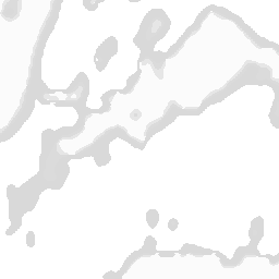
Europe precipitation radar and forecast
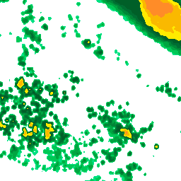
TIME RESOLUTION: 15min (up to +1h 45min), 3h (up to 3d)
HISTORY: 1 day
UPDATE: 15 minutes
MINZOOM: 3, MAXZOOM: 11
REGIONS: Europe:Andorra, Belgium, Estonia, Finland, France, Germany, Ireland, Liechtenstein, Luxembourg, Monaco, Norway, Slovenia, Spain, Sweden, Switzerland, The Netherlands, UK, Austria*, Croatia*, Czechia*, Denmark*, Italy*, Latvia*, Poland*, Portugal* *partial coverage
North America radar and precipitation forecast
TIME RESOLUTION: 15min (up to +1h 45min), 3h (up to 3d)
HISTORY: 1 day
UPDATE: 10 minutes
MINZOOM: 3, MAXZOOM: 12
REGIONS: Continental USA, Alaska, Hawaii, Puerto Rico, Canada (partial coverage)
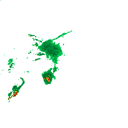
Global precipitation forecast with precipitation type
TIME RESOLUTION: 15min (up to 16h), 3h (up to 3d)
HISTORY: 6h
UPDATE: 12h
MINZOOM: 4, MAXZOOM: 9
REGIONS: global
Satellite
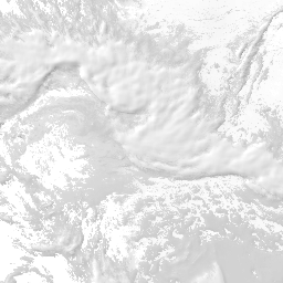
TIME RESOLUTION: 1h
HISTORY: 6h
UPDATE: 1h
MINZOOM: 3, MAXZOOM: 11
REGIONS: global
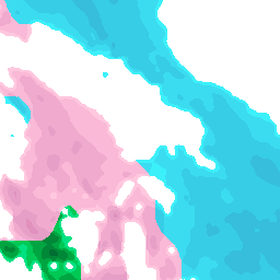
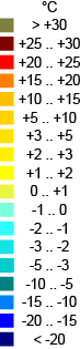
Temperature
TIME RESOLUTION: 1h (up to 1d 12h), 3h (up to 5d 12h)
HISTORY: 0h
UPDATE: 12h
MINZOOM: 3, MAXZOOM: 11
REGIONS: global
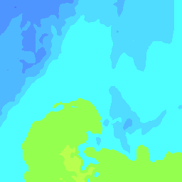
Cloud cover
TIME RESOLUTION: 1h (up to 1d 12h), 3h (up to 3d 12h)
HISTORY: 0h
UPDATE: 12h
MINZOOM: 3, MAXZOOM: 11
REGIONS: global
Wind symbol with speed and direction
TIME RESOLUTION: 1h (up to 1d), 3h (up to 3d)
HISTORY: 0h
UPDATE: 12h
MINZOOM: 4, MAXZOOM: 11
REGIONS: global
Zoom levels correspond to google map zoom levels.
Global region latitudes: minLat: -73, maxLat: 73, minLon: -180, maxLon: 180
Other map layers available upon request.
/api/v1/capabilities
{
  "images": [
    {
      "title": "Temperature",
      "description": "Global surface temperature",
      "formats": [
        "image/png"
      ],
      "colorschemes": [
        "default"
      ],
      "attribution": null,
      "extent": {
        "minLat": -72.8,
        "maxLat": 72.8,
        "minLon": -180,
        "maxLon": 180,
        "minZoom": 3,
        "maxZoom": 11
      },
      "times": {
        "updated": "2022-01-27T00:00:00Z",
        "available": [
          "2022-01-27T06:00:00Z",
          "2022-01-27T07:00:00Z",
          "2022-01-27T08:00:00Z",
          "2022-01-27T09:00:00Z",
          "2022-01-27T10:00:00Z",
          "2022-01-27T11:00:00Z",
          "2022-01-27T12:00:00Z",
          "2022-01-27T13:00:00Z"
        ],
        "current": 8
      },
      "id": 2
    },
    {
      "title": "Europe precipitation radar and forecast",
      "description": "Radar + radar forecast + cell simulated precipitation with precipitation type (EU)",
      "formats": [
        "image/png"
      ],
      "colorschemes": [
        "default"
      ],
      "attribution": "FMI, SMHI, Met Norway, Estonian Weather Service, DMI, KNMI, KMI, Meteo France, DWD, Met Office, AEMET, Met Eireann, MeteoSchweiz, ARSO",
      "extent": {
        "minLat": -40.89080609,
        "maxLat": 79.171,
        "minLon": -89.91202346,
        "maxLon": 89.91202346,
        "minZoom": 3,
        "maxZoom": 11
      },
      "times": {
        "updated": "2022-01-27T13:45:00Z",
        "available": [
          "2022-01-13T04:45:00Z",
          "2022-01-13T05:00:00Z",
          "2022-01-13T05:15:00Z",
          "2022-01-13T05:30:00Z",
          "2022-01-13T05:45:00Z",
          "2022-01-13T06:00:00Z",
          "2022-01-13T06:15:00Z",
          "2022-01-13T06:30:00Z",
          "2022-01-13T06:45:00Z",
          "2022-01-13T07:00:00Z"
        ],
        "current": 197
      },
      "id": 5
    }
  ]
}
Tile
Tile endpoint is used to obtain weather map tiles for the given layer and color scheme
id
Layer id
x
X index of the requested tile
y
Y index of the requested tile
z
Zoom level of the requested tile
time
UTC timestamp value for the data to retrieve in ISO 8601 format. Must appear in the available times list
token
Access token as provided by authorization endpoint
colorscheme (optional)
Layer color scheme. Must appear in the color scheme list returned by capabilities endpoint
/api/v1/image/tile/:z/:x/:y/:time/:id
Legend
Legend endpoint is used to obtain legend image for a color scheme
colorscheme
Color scheme id. Must appear in the color scheme list returned by capabilities endpoint
id
Layer id
token
Access token as provided by authorization endpoint
/api/v1/legend/:colorscheme/:id
Air Quality
Air quality forecasts: an air quality index (AQI) that summarizes air pollution taking into account multiple components (carbon monoxide, nitrogen dioxide, ozone, sulfur dioxide and particulate matter). The forecast is based on observations and numerical modeling, resulting in AQI values calculated based on the United States EPA standard.
Hourly
Hourly air quality forecasts.
location
"Longitude,latitude" or location identifier (id) from the location endpoint
periods (optional)
Number of time steps (default 24, maximum 84)
tz (optional)
Time zone in response (IANA time zone database names)
Click the schema button to see a complete list of available parameters.
/api/v1/air-quality/forecast/hourly/:location
{
  "forecast": [
    {
      "time": "2022-02-03T10:00Z",
      "pollutant": "Particulate matter <2.5um",
      "AQI": 102,
      "AQI_CO": 8,
      "AQI_NO2": 6,
      "AQI_O3": 24,
      "AQI_SO2": 4,
      "AQI_PM10": 64,
      "AQI_PM2P5": 102
    },
    {
      "time": "2022-02-03T11:00Z",
      "pollutant": "Particulate matter <2.5um",
      "AQI": 101,
      "AQI_CO": 7,
      "AQI_NO2": 7,
      "AQI_O3": 25,
      "AQI_SO2": 6,
      "AQI_PM10": 63,
      "AQI_PM2P5": 101
    }
  ]
}Daily
Daily air quality forecasts.
location
"Longitude,latitude" or location identifier (id) from the location endpoint
periods (optional)
Number of time steps (default 3, maximum 3)
Click the schema button to see a complete list of available parameters.
/api/v1/air-quality/forecast/daily/:location
{
  "forecast": [
    {
      "date": "2022-02-03",
      "AQI": 111,
      "pollutant": "Particulate matter <2.5um",
      "AQI_CO": 7,
      "AQI_NO2": 48,
      "AQI_GO3": 71,
      "AQI_SO2": 59,
      "AQI_PM2P5": 111,
      "AQI_PM10": 66
    },
    {
      "date": "2022-02-04",
      "AQI": 129,
      "pollutant": "Ozone",
      "AQI_CO": 23,
      "AQI_NO2": 35,
      "AQI_GO3": 129,
      "AQI_SO2": 49,
      "AQI_PM2P5": 106,
      "AQI_PM10": 65
    }
  ]
}Climate
Weather statistics.
Monthly climate
Averages and other summary weather statistics, by month. The values are based on a 30-year period 1991--2020.
location
"Longitude,latitude" or location identifier (id) from the location endpoint
tempunit (optional)
Temperature unit: "C", "F" (default "C")
Click the schema button to see a complete list of available parameters.
/api/v1/climate/monthly/:location
{
  "climate": [
    {
      "month": "01",
      "dayMaxTemp": -0.76,
      "dayMinTemp": -5.68,
      "dayAvgTemp": -3.2,
      "precipSum": 55.17,
      "dailyPrecip": 1.78,
      "rainDays": 19.09,
      "frostDays": 26.42
    },
    {
      "month": "02",
      "dayMaxTemp": -1.09,
      "dayMinTemp": -6.64,
      "dayAvgTemp": -3.86,
      "precipSum": 38.34,
      "dailyPrecip": 1.37,
      "rainDays": 14.62,
      "frostDays": 24.6
    },
    {
      "month": "03",
      "dayMaxTemp": 2.62,
      "dayMinTemp": -4.01,
      "dayAvgTemp": -0.69,
      "precipSum": 37.21,
      "dailyPrecip": 1.2,
      "rainDays": 13.68,
      "frostDays": 24.75
    }
  ]
}History
Weather History API provides observational weather information from the past by showing measured weather parameters in a certain location at a specific date. The API delivers all the measured weather parameters as both daily summary values and hourly values. The queries can be made based on a given day and coordinate point. The API will respond with observational data from the nearest relevant weather station or from weather forecast model data (augmented observation). Augmented observations are provided when the closest weather station with sufficient observations is too far away to give representative information. History data is available from January 2009.
Read more about weather historyPoint history
lon
Longitude
lat
Latitude
date
Date in YYYYMMDD format
days (optional)
Add-on feature: number of days returend, starting at "date" (default 1, maximum 14)
tempunit (optional)
Temperature unit (F, C; default C)
windunit (optional)
Wind unit (MS, KTS, KMH, MPH, BFT; default MS)
precunit (optional)
Precipitation unit (MM, IN)
lang (optional)
Language (ISO 639-1 codes). Options: de, en, es, fr, it, pl, ru, fi, sv, nl, ko, pt, th, tr, zh, zh_TW (Chinese in Taiwan), zh_CN (Chinese in China). (default en)
Click the schema button to see a complete list of available parameters.
{
  "station": {
    "name": "Tholen Wp",
    "lon": 4.2,
    "lat": 51.48
  },
  "hourly": {
    "date": {
      "pretty": "00:00 on January 23, 2016",
      "year": "2016",
      "month": "01",
      "day": "23",
      "hour": "00",
      "min": "00",
      "tz": "Europe/Amsterdam"
    },
    "utcdate": {
      "iso8601": "2016-01-22T23:00",
      "year": "2016",
      "month": "01",
      "day": "22",
      "hour": "23",
      "min": "00",
      "tz": "UTC"
    },
    "observations": [
      {
        "dt": {
          "pretty": "00:00 on January 23, 2016",
          "year": "2016",
          "month": "01",
          "day": "23",
          "hour": "00",
          "min": "00",
          "tz": "Europe/Amsterdam"
        },
        "dtu": {
          "iso8601": "2016-01-22T23:00",
          "year": "2016",
          "month": "01",
          "day": "22",
          "hour": "23",
          "min": "00",
          "tz": "UTC"
        },
        "t": "5.7",
        "d": "5.6",
        "rh": "99",
        "ws": "4",
        "gust": "4",
        "wd": "230",
        "wn": "southwest",
        "v": "400",
        "p": "1022.2",
        "tf": "3",
        "pr1": "",
        "sT": "Haze",
        "s": "600",
        "fog": "1",
        "rain": "0",
        "snow": "0",
        "hail": "0",
        "thunder": "0",
        "tornado": "0"
      }
    ]
  },
  "dailysummary": {
    "dt": {
      "pretty": "00:00 on January 23, 2016",
      "year": "2016",
      "month": "01",
      "day": "23",
      "hour": "00",
      "min": "00",
      "tz": "Europe/Amsterdam"
    },
    "fog": "1",
    "rain": "0",
    "snow": "0",
    "snowfall": "",
    "snowfallmonthtodate": "",
    "snowfallsincejul1": "",
    "snowdepth": "",
    "hail": "0",
    "thunder": "0",
    "tornado": "0",
    "ta": "6.2",
    "da": "5.6",
    "pa": "1029.7",
    "wsa": "3.5",
    "wna": "north",
    "wda": "219",
    "va": "4857",
    "rha": "96",
    "tx": "8",
    "tn": "4",
    "rhx": "100",
    "rhn": "87",
    "dx": "7",
    "dn": "4",
    "px": "1033.5",
    "pn": "1022.2",
    "wsx": "5",
    "wsn": "2",
    "vx": "10600",
    "vn": "390",
    "pr24": "",
    "prtype": "noprec"
  }
}Warnings
Governmental severe weather warnings are currently delivered from: Australia, Austria, Belgium, Canada, Denmark, Estonia, Finland, France, Germany, Ireland, Italy, Japan, Latvia, Luxembourg, Netherlands, Norway, Poland, Portugal, Spain, Sweden, Switzerland, United Kingdom and United States.
Read more about weather warningsPoint warnings
location
"Longitude, latitude" or location identifier (id) from the location endpoint
future (optional)
Whether to return warnings starting more than 24 hours from now (boolean: default 0)
Click the schema button to see a complete list of available parameters.
/api/v1/warning/:location
{
  "warnings": [
    {
      "type": "FO",
      "significance": "Y",
      "attribution": null,
      "validFrom": "2021-01-08T10:17:00Z",
      "validUntil": "2021-01-08T17:00:00Z",
      "description": [
        {
          "lang": "en",
          "text": "Dense Fog Advisory issued January 08 at 4:17AM CST until January 08 at 11:00AM CST by NWS Minneapolis&10;&10;Anoka; Benton; Blue Earth; Brown; Carver; Chippewa; Chisago; Douglas; Hennepin; Isanti; Kanabec; Kandiyohi; Lac Qui Parle; Le Sueur; Martin; McLeod; Meeker; Mille Lacs; Morrison; Nicollet; Pope; Ramsey; Redwood; Renville; Scott; Sherburne; Sibley; Stearns; Stevens; Swift; Todd; Watonwan; Wright; Yellow Medicine&10;&10;...DENSE FOG ADVISORY REMAINS IN EFFECT UNTIL 11 AM CST THIS&10;MORNING...&10;* WHAT...Visibility one quarter mile or less in dense fog.&10;* WHERE...Portions of central, east central, south central,&10;southwest and west central Minnesota.&10;* WHEN...Until 11 AM CST Friday.&10;* IMPACTS...Hazardous driving conditions due to low visibility.&10;* ADDITIONAL DETAILS...Slick spots on roads, overpasses, and&10;sidewalks are also possible as the fog freezes on exposed&10;surfaces.&10;&10;If driving, slow down, use your headlights, and leave plenty of&10;distance ahead of you."
        }
      ],
      "attributionUrl": null,
      "link": "https://alerts.weather.gov/cap/wwacapget.php?x=MN126188507444.DenseFogAdvisory.126188517F10MN.MPXNPWMPX.6f0fa4bac3937d8409b5648ff85e9eea",
      "sent": "2021-01-08T10:17:00Z",
      "name": "Fog",
      "significanceDescription": "Potentially dangerous"
    }
  ]
}Warning type names
Metadata for all warning types.
Click the schema button to see a complete list of available parameters.
/api/v1/warning/types
{
  "AQ": {
    "name": "Air quality"
  },
  "AS": {
    "name": "Volcanic ashfall"
  },
  "AV": {
    "name": "Avalanche"
  },
  "CD": {
    "name": "Civil danger"
  },
  "CE": {
    "name": "Coastal event"
  }
}Marine
Marine forecasts of waves and sea temperatures.
Hourly
Hourly marine forecasts.
location
"Longitude,latitude" or location identifier (id) from the location endpoint
periods (optional)
Number of time steps (default 24, maximum 168)
tempunit (optional)
Temperature unit: "C", "F" (default "C")
tz (optional)
Time zone in response (IANA time zone database names)
Click the schema button to see a complete list of available parameters.
/api/v1/marine/forecast/hourly/:location
{
  "forecast": [
    {
      "time": "2020-07-03T11:00",
      "sigWaveHeight": 0.95,
      "waveDir": 225,
      "sigSwellHeight": 0.02,
      "seaTemp": 18,
      "swimTemp": 18
    },
    {
      "time": "2020-07-03T12:00",
      "sigWaveHeight": 1.01,
      "waveDir": 225,
      "sigSwellHeight": 0.02,
      "seaTemp": 18,
      "swimTemp": 18
    },
    {
      "time": "2020-07-03T13:00",
      "sigWaveHeight": 1,
      "waveDir": 225,
      "sigSwellHeight": 0.02,
      "seaTemp": 18,
      "swimTemp": 18
    }
  ]
}Daily
Daily marine forecasts.
location
"Longitude,latitude" or location identifier (id) from the location endpoint
periods (optional)
Number of time steps (default 7, maximum 14)
tempunit (optional)
Temperature unit: "C", "F" (default "C")
Click the schema button to see a complete list of available parameters.
/api/v1/marine/forecast/daily/:location
{
  "forecast": [
    {
      "date": "2020-07-03",
      "maxSigWaveHeight": 1.01,
      "maxSwellHeight": 0.05,
      "maxSeaTemp": 19,
      "maxSwimTemp": 18
    },
    {
      "date": "2020-07-04",
      "maxSigWaveHeight": 1.18,
      "maxSwellHeight": 0.18,
      "maxSeaTemp": 18,
      "maxSwimTemp": 17
    },
    {
      "date": "2020-07-05",
      "maxSigWaveHeight": 0.99,
      "maxSwellHeight": 0.99,
      "maxSeaTemp": 18,
      "maxSwimTemp": 18
    }
  ]
}Ski
Ski resort weather conditions and site information.
Current
Ski resort conditions.
location
"Longitude,latitude" or location identifier (id) from the location endpoint
sites (optional)
Number of ski sites (default 1, maximum 5)
radius (optional)
Maximum distance to ski site (default 500 km)
Click the schema button to see a complete list of available parameters.
/api/v1/ski/current/:location
{
  "locations": [
    {
      "name": "Lake Louise",
      "countryCode": "ca",
      "countryName": "Canada",
      "state": "Alberta",
      "city": "Lake Louise, AB",
      "postalCode": "T0L 1E0",
      "street": "Banff National Park",
      "houseNumber": null,
      "address": "Banff National Park, Lake Louise, AB, T0L 1E0",
      "longitude": -116.159228,
      "latitude": 51.439332,
      "openFrom": "08:30",
      "openUntil": "16:00",
      "isOpen": true,
      "altitudeBase": 1646,
      "altitudePeak": 2637,
      "primarySurfaceCondition": "Gripping snow",
      "liftsOpen": 2,
      "lifts": 7,
      "hasSkiing": true,
      "kmNordic": null,
      "kmPistes": 139,
      "kmOpen": 7,
      "hasValleyRun": true,
      "valleyRunOpen": "true",
      "hasTobogganRuns": false,
      "kmTobogganRuns": null,
      "lastSnowDate": "2020-11-01",
      "lastSnowAmount": null,
      "nightSkiing": false,
      "snowDepthPeak": 52,
      "snowDepthBase": 43,
      "hasFunPark": true,
      "funParkOpen": true,
      "updated": "2020-11-05T00:00:00Z"
    },
    {
      "name": "Sunshine Village",
      "countryCode": "ca",
      "countryName": "Canada",
      "state": "Alberta",
      "city": "Banff",
      "postalCode": "T0L 0C0",
      "street": "Banff-Nationalpark",
      "houseNumber": null,
      "address": "Banff-Nationalpark, Banff, T0L 0C0",
      "longitude": -115.761005,
      "latitude": 51.113248,
      "openFrom": "08:30",
      "openUntil": "16:00",
      "isOpen": false,
      "altitudeBase": 1660,
      "altitudePeak": 2730,
      "primarySurfaceCondition": null,
      "liftsOpen": 0,
      "lifts": 10,
      "hasSkiing": false,
      "kmNordic": null,
      "kmPistes": 109,
      "kmOpen": 0,
      "hasValleyRun": true,
      "valleyRunOpen": "false",
      "hasTobogganRuns": true,
      "kmTobogganRuns": null,
      "lastSnowDate": null,
      "lastSnowAmount": null,
      "nightSkiing": false,
      "snowDepthPeak": null,
      "snowDepthBase": null,
      "hasFunPark": true,
      "funParkOpen": false,
      "updated": "2020-11-05T00:00:00Z"
    }
  ]
}Usage
Monitor your API usage.
Month's usage
Usage by month.
month
Month (e.g. "2021-03")
user
Username
password
Administrative password
/usage/month/:month
{
  "apis": [
    {
      "name": "Weather API",
      "hits": 32529
    },
    {
      "name": "Map API",
      "hits": 12020
    },
    {
      "name": "Administrative",
      "hits": 0
    }
  ],
  "hits": 44549
}
Day's usage
Usage by day.
day
Day (e.g. "2021-03-15")
user
Username
password
Administrative password
/usage/day/:day
{
  "apis": [
    {
      "name": "Weather API",
      "hits": 380
    },
    {
      "name": "Map API",
      "hits": 785
    },
    {
      "name": "Administrative",
      "hits": 0
    }
  ],
  "hits": 1165
}